Create shapefiles#
Merge LSOAs to create shapefiles for:
IVT catchment areas
Ambulance trusts
1 Import libraries and set file paths#
from dataclasses import dataclass
import geopandas as gpd
import os
import pandas as pd
# Define file paths
@dataclass(frozen=True)
class Paths:
    '''Singleton object for storing paths to data and database.'''

    data = './data'
    collated = 'collated_data_amb.csv'

    shapefiles = 'shapefiles'
    ivt_catchment = 'ivt_catchment.shp'
    amb_catchment = 'amb_catchment.shp'
    lsoa_shp = ('Lower_layer_super_output_areas_(E+W)_2011_Boundaries_' +
                '(Generalised_Clipped)_V2.zip')


paths = Paths()
2 Load data#
2.1 Load data with closest IVT and ambulance trust per LSOA#
df_lsoa = pd.read_csv(os.path.join(paths.data, paths.collated))
df_lsoa.head()
| LSOA | admissions | closest_ivt_unit | closest_ivt_unit_time | closest_mt_unit | closest_mt_unit_time | closest_mt_transfer | closest_mt_transfer_time | total_mt_time | ivt_rate | ... | age_band_males_65 | age_band_males_70 | age_band_males_75 | age_band_males_80 | age_band_males_85 | age_band_males_90 | ambulance_service | local_authority_district_22 | LAD22NM | country | |
|---|---|---|---|---|---|---|---|---|---|---|---|---|---|---|---|---|---|---|---|---|---|
| 0 | Welwyn Hatfield 010F | 0.666667 | SG14AB | 18.7 | NW12BU | 36.9 | CB20QQ | 39.1 | 57.8 | 6.8 | ... | 33 | 28 | 26 | 14 | 5 | 3 | East of England | Welwyn Hatfield | Welwyn Hatfield | England |
| 1 | Welwyn Hatfield 012A | 4.000000 | SG14AB | 19.8 | NW12BU | 36.9 | CB20QQ | 39.1 | 58.9 | 6.8 | ... | 24 | 18 | 21 | 12 | 5 | 4 | East of England | Welwyn Hatfield | Welwyn Hatfield | England |
| 2 | Welwyn Hatfield 002F | 2.000000 | SG14AB | 18.7 | NW12BU | 38.0 | CB20QQ | 39.1 | 57.8 | 6.8 | ... | 33 | 28 | 7 | 5 | 9 | 2 | East of England | Welwyn Hatfield | Welwyn Hatfield | England |
| 3 | Welwyn Hatfield 002E | 0.666667 | SG14AB | 18.7 | NW12BU | 36.9 | CB20QQ | 39.1 | 57.8 | 6.8 | ... | 24 | 17 | 15 | 16 | 9 | 1 | East of England | Welwyn Hatfield | Welwyn Hatfield | England |
| 4 | Welwyn Hatfield 010A | 3.333333 | SG14AB | 18.7 | NW12BU | 36.9 | CB20QQ | 39.1 | 57.8 | 6.8 | ... | 33 | 28 | 28 | 13 | 10 | 3 | East of England | Welwyn Hatfield | Welwyn Hatfield | England |
5 rows × 115 columns
2.2 Load LSOA shape file#
The following will load the shape file of the England and Wales LSOA (Lower Super Output Areas) into a GeoPandas DataFrame. Note that we can set the crs (Coordinate Reference System) when loading a GeoPandas DataFrame. EPSG:27700 is the crs to use when geography is in BNG (British National Grid Eastings and Northings).
Other crs to consider for other data projections:
EPSG:27700 OSGB 1936 / British National Grid – United Kingdom Ordnance Survey. Co-ordinates are in Eastings (X) and Northings (Y).
EPSG:4326 WGS 84 – WGS84 - World Geodetic System 1984. Co-ordinates are in Longitude (X) and Latitude (Y).
EPSG:3857 - projection for displaying lat/long as a flat map
gdf_lsoa = gpd.read_file(os.path.join(
    paths.data, paths.shapefiles, paths.lsoa_shp),
    crs='EPSG:27700')
gdf_lsoa.head()
| LSOA11CD | LSOA11NM | LSOA11NMW | geometry | |
|---|---|---|---|---|
| 0 | E01000001 | City of London 001A | City of London 001A | POLYGON ((532105.092 182011.230, 532162.491 18... |
| 1 | E01000002 | City of London 001B | City of London 001B | POLYGON ((532746.813 181786.891, 532671.688 18... |
| 2 | E01000003 | City of London 001C | City of London 001C | POLYGON ((532135.145 182198.119, 532158.250 18... |
| 3 | E01000005 | City of London 001E | City of London 001E | POLYGON ((533807.946 180767.770, 533649.063 18... |
| 4 | E01000006 | Barking and Dagenham 016A | Barking and Dagenham 016A | POLYGON ((545122.049 184314.931, 545271.917 18... |
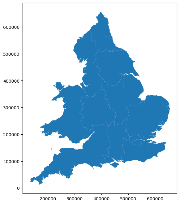
View a simple map of this data.
gdf_lsoa.plot(figsize=(8,8));
3 Merge LSOAs together to create shapefiles#
3.1 Define function for creating shapefiles#
The method used is explained with the example of creating a shapefile of IVT catchment areas:
Add column to geopandas dataframe - using LSOA as common value, add field ‘closest_ivt_unit’. Match gdf_lsoa[‘LSOA11NMW’] with df_lsoa[‘LSOA’] and add df_lsoa[‘closest_ivt_unit’] to gdf_lsoa[‘closest_ivt_unit’] - see here for stackoverflow explanation
Ensure no inner lines from original polygons using buffer(0.0001) - see here for stackoverflow explanation
Merge LSOA polygons that are in same IVT unit catchment area using dissolve() - see here for geopandas tutorial on aggregation with dissolve
def create_shapefile(col, file_path, gdf=gdf_lsoa, df=df_lsoa):
'''
Merges LSOAs together based on specified column to create a shapefile
Inputs:
- col - string, column to group LSOAs based on
- file_path - string, file path to save shapefile to
- gdf - geopandas dataframe, created from LSOA shapefile
- df - dataframe, information for each LSOA
'''
# Add column to geopandas LSOA dataframe
gdf = gdf.merge(
df[[col, 'LSOA']], left_on='LSOA11NM', right_on='LSOA', how='left')
gdf = gdf.drop('LSOA', axis=1)
# Shortern column to first 10 characters (since that's what it will be
# renamed to for the shapefile) (else get warning message)
shp_col = col[:10]
gdf = gdf.rename(columns={col: shp_col})
# Ensure no inner lines (from the original polygons)
gdf['geometry'] = gdf['geometry'].buffer(0.0001)
# Now merge LSOA on specified column
gdf_catchment = gdf.dissolve(by=shp_col)
# Save to shapefile
gdf_catchment.to_file(file_path)
# Show save location
display(f'Saved to {file_path}')
# Display head of dataframe
display(gdf_catchment.head())
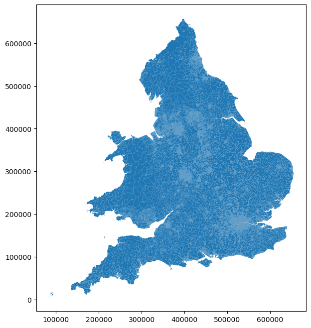
# Plot shapefile
gdf_catchment.plot(figsize=(8,8));
3.2 Create IVT catchment shapefile#
create_shapefile(
    'closest_ivt_unit',
    os.path.join(paths.data, paths.shapefiles, paths.ivt_catchment))
'Saved to ./data/shapefiles/ivt_catchment.shp'
| geometry | LSOA11CD | LSOA11NM | LSOA11NMW | |
|---|---|---|---|---|
| closest_iv | ||||
| B152TH | MULTIPOLYGON (((403011.723 266679.152, 402597.... | E01008881 | Birmingham 067A | Birmingham 067A |
| B714HJ | MULTIPOLYGON (((395950.714 272162.470, 395950.... | E01008899 | Birmingham 037A | Birmingham 037A |
| BA13NG | POLYGON ((354665.594 144552.500, 354665.594 14... | E01014370 | Bath and North East Somerset 007A | Bath and North East Somerset 007A |
| BA214AT | MULTIPOLYGON (((330365.588 98427.209, 330281.9... | E01019886 | East Devon 005A | East Devon 005A |
| BB23HH | POLYGON ((369965.000 416593.000, 370071.000 41... | E01004803 | Bolton 001B | Bolton 001B |

3.3 Create ambulance trust shapefile#
create_shapefile(
    'ambulance_service',
    os.path.join(paths.data, paths.shapefiles, paths.amb_catchment))
'Saved to ./data/shapefiles/amb_catchment.shp'
| geometry | LSOA11CD | LSOA11NM | LSOA11NMW | |
|---|---|---|---|---|
| ambulance_ | ||||
| East Midlands | MULTIPOLYGON (((433631.972 296489.554, 433631.... | E01013128 | North East Lincolnshire 010A | North East Lincolnshire 010A |
| East of England | MULTIPOLYGON (((503939.688 193345.500, 503939.... | E01015589 | Peterborough 004A | Peterborough 004A |
| Isle of Wight | MULTIPOLYGON (((451071.500 75523.100, 451071.5... | E01017282 | Isle of Wight 006A | Isle of Wight 006A |
| London | MULTIPOLYGON (((510971.125 170480.219, 510971.... | E01000001 | City of London 001A | City of London 001A |
| North East | MULTIPOLYGON (((418029.261 516224.682, 418029.... | E01008162 | Gateshead 027A | Gateshead 027A |